


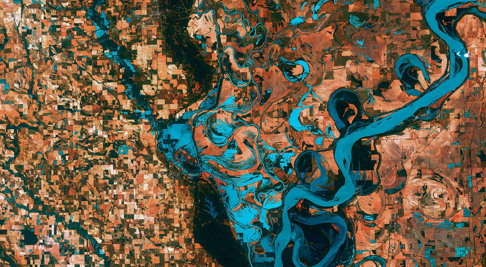
SATELLITE WATER MONITORING
We use Satellite Images and Artificial Intelligence to monitor water resources and oceans around the world.

ABOUT US
ORBTY has a team of specialists in remote sensing of aquatic environments which develops technologies for monitoring water resources using satellite images.
The large number of satellites in orbit and the high computational processing capacity available allow for a detailed analysis of the quality and dynamics of inland and oceanographic water bodies.
Therefore, ORBTY aims to provide the most modern satellite monitoring technologies to improve the management of reservoirs, rivers, lakes and oceanographic operations.
SERVICES
Discover our new platform GEMAP
GEMAP (Geospatial Mapping of Aquatic Parameters) is an innovative platform that leverages satellite imagery to monitor water quality in reservoirs. With accurate and continuous data, GEMAP enables the tracking of essential parameters, helping to optimize management, reduce risks, and promote sustainability in reservoir management.


Reservoir Monitoring
We offer reservoir monitoring using satellite images for different morphometric and water quality parameters.

Metocean satellite products
ORBTY's scientific team applies advanced processing methods to generate high-quality data on geophysical parameters such as Sea surface temperature, Chlorophyll-a concentration, Wind speed and direction and Water vapor.

Macrophyte Monitoring
We monitor aquatic macrophytes in reservoirs using satellite imagery.

Aquaculture Monitoring
Using satellite imagery, we monitor the water quality in aquaculture tanks and lakes.

Maritime Surveillance
We provide accurate and reliable satellite and weather information for maritime surveillance anywhere in the world.

Drone Aerial Surveying
We generate data through drone aerial surveys, enabling more informed decision-making in areas such as topography, mining, or environmental services.

Carbon Credits
We estimate vegetation biomass using satellite imagery, providing an efficient and cost-effective method for identifying areas suitable for carbon credits.
PARTNERSHIPS

Fabiano Porto
Diretor Executivo Instituto Regeneração Global


"Working with Orbty was amazing. We worked together in the cooperation network for the Paraíba do Sul River Park and Orbty was fundamental in this process. In addition to the accurate monitoring of various aspects of the river, everyone at Orbty was always willing and competent for all activities! I strongly recommend Orbty both in terms of technological solution for water resources and in the service and relationship of the team."

Theodoros
CEO of AntiAlgas
"Orbty and its entire team helped us to solve the problem of monitoring contaminants in remote water resources with a very professional service.


Marielle
Researcher at IRD


"The ORBTY services have been remarkably reliable in meeting our needs and objectives. It was important to us to meet deadlines and the company's help was crucial to achieve the success of the project."


Our team
Gustavo Nagel
CEO
Water Engineer (UFPel)
Master in Remote Sensing (INPE)
Phd candidate in Ocean and Earth Science (University of Southampton - United Kingdom).
Researcher at the University of Southampton

Frederico Nagel
COO
Civil Engineer (UFSM)
Post-graduate degree in Entrepreneurship and Technological Innovation in Engineering (UNESP / UNIVESP)
MBA in Construction Management and Quality in Civil Construction (IPOG)

Carolline Cairo
Senior Remote Sensing Specialist
Environmental Engineer (FAESA)
Master in Remote Sensing (INPE)
PhD in Remote Sensing (INPE)

Matheus Correia
Geospatial Platform Developer
Computational Physicist (UFF)
Master in Applied Computing (INPE)
_edited.jpg)
![Cópia de Cópia de Cópia de Cópia de Design sem nome [Tamanho original] (3)_edited_edited.j](https://static.wixstatic.com/media/3b307f_5f5d9c2694784822b155f3fd6e041d29~mv2.jpg/v1/fill/w_224,h_219,al_c,q_80,usm_0.66_1.00_0.01,enc_avif,quality_auto/C%C3%B3pia%20de%20C%C3%B3pia%20de%20C%C3%B3pia%20de%20C%C3%B3pia%20de%20Design%20sem%20nome%20%5BTamanho%20original%5D%20(3)_edited_edited_j.jpg)
Marouan Bouali
Senior Computer Vision Scientist
Computer Science Engineer (Télécom Physique Strasbourg)
Master in Signal and Image Processing (University of Strasbourg Louis Pasteur)
PhD in Signal and Image Processing (Télécom ParisTech)
CONTACT
Address
We are located at NEXUS: Parque Tecnológico de, Rod. Pres. Dutra, 500 - Eugênio de Melo, São José dos Campos - SP, 12247-016
Information
Social Media
For any information, questions or comments, fill out the form please: